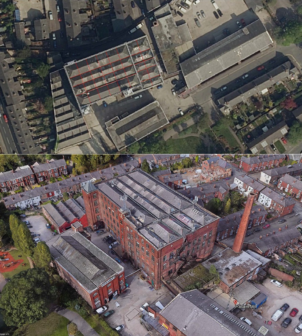
Google Earth aerial with structural grid overlay, the starting point for every appraisal.
A long-running interest in reading old buildings, what they are, how they were set out, and what they could become.
Over the years I have worked on many listed and historic buildings. Mostly industrial revolution Victorian mills. What follows is a study I made for a building in Stockport I hadn't visited before. It was worked out from the desk top with aerial views, photographs, historical plans, and experience of the architectural typology.
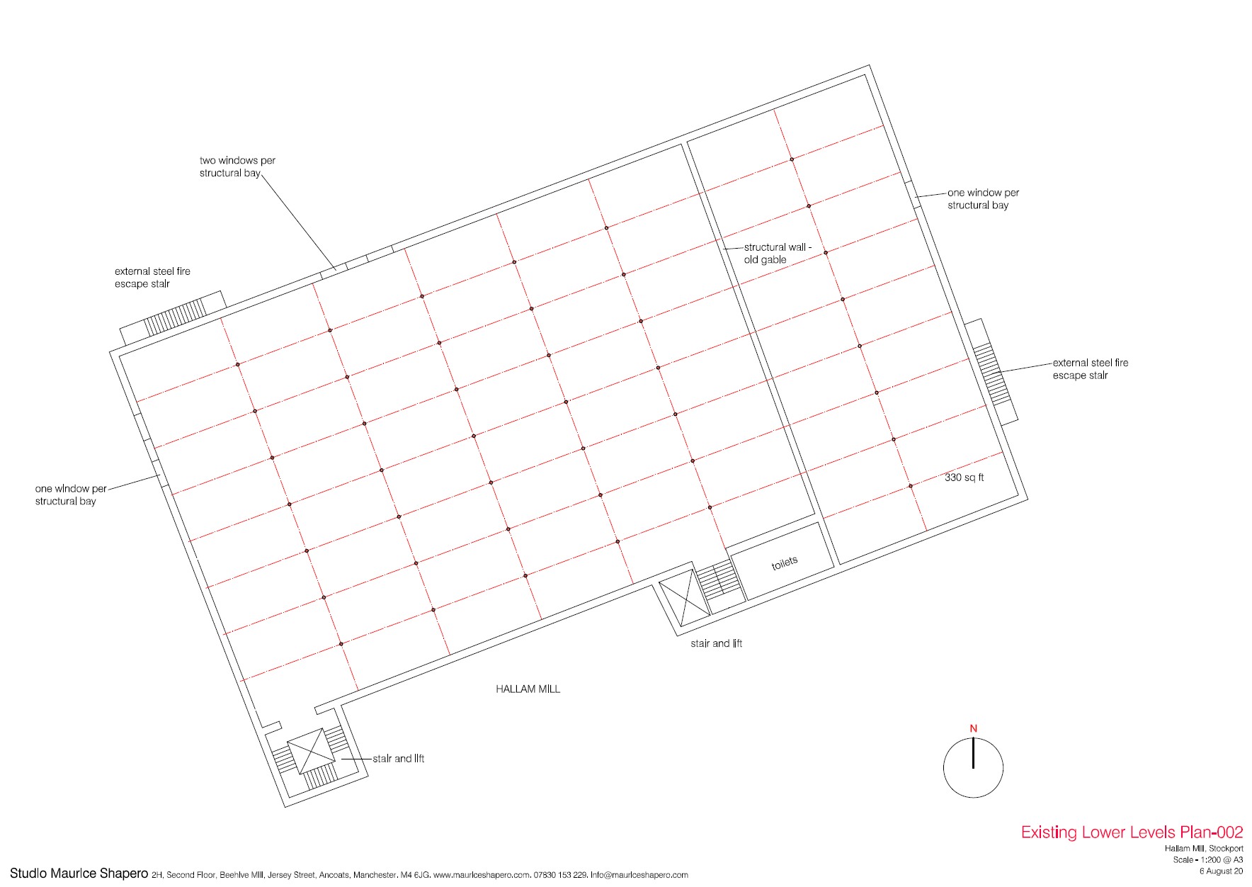
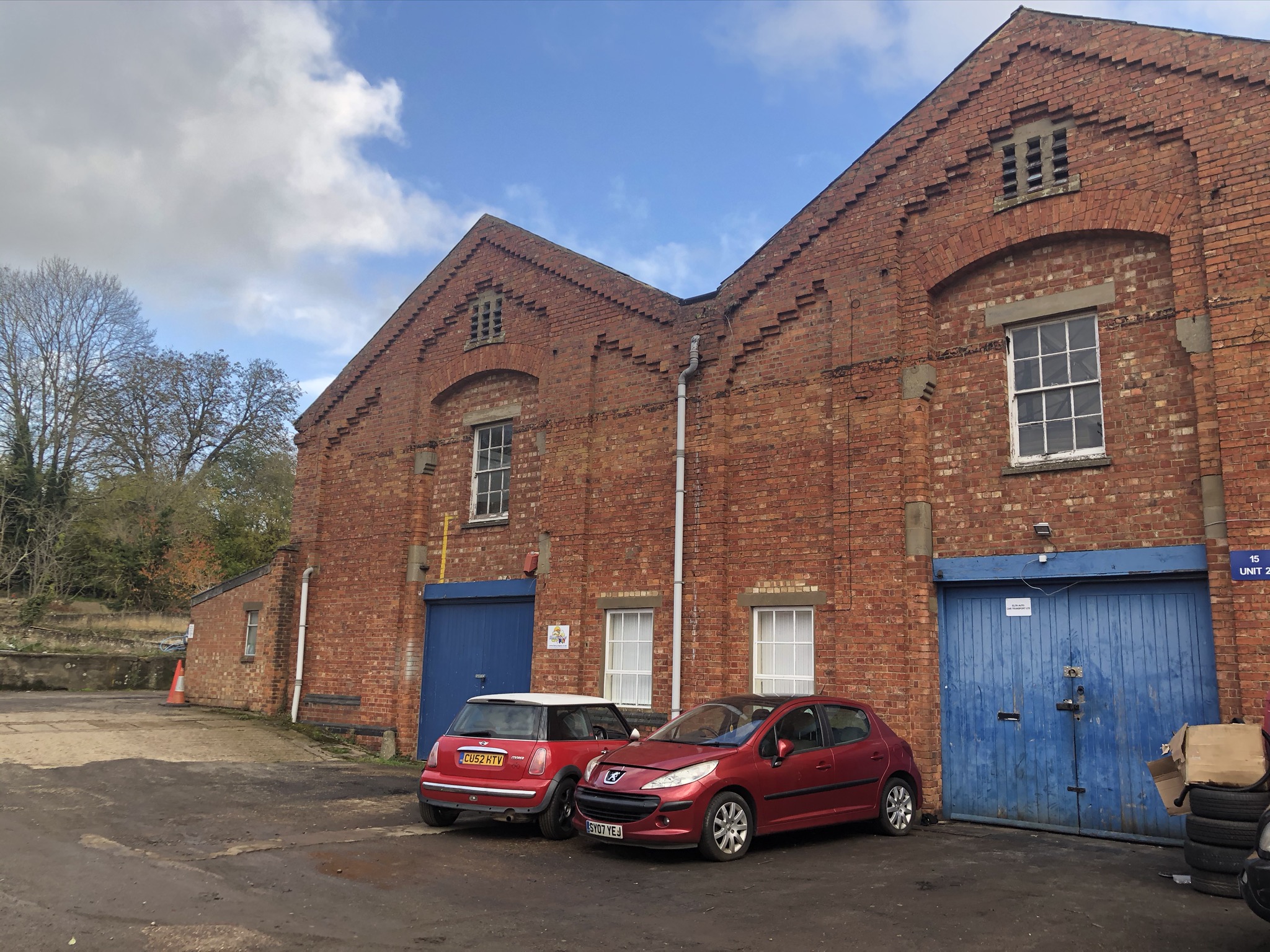
Hallam Mill is a substantial Victorian cotton mill in Stockport, sitting in the middle of a residential area off the A6. A property developer asked me to look at it and work out its potential, its structure and what it could hold. I had never been to the building. I had no measured survey, no floor plans, no structural information. Using Google Earth, Google Street View and online photography, I worked out the structural grid of the building, column positions, bay widths, the north-light roof structure, window rhythms, internal circulation and fire escape travel distances, site access points and the relationship to the surrounding terrace rows.
Google Earth aerial with structural grid overlay, the starting point for every appraisal.
A hand drawn sketch exploring daylight penetration by forming a central light atrium.
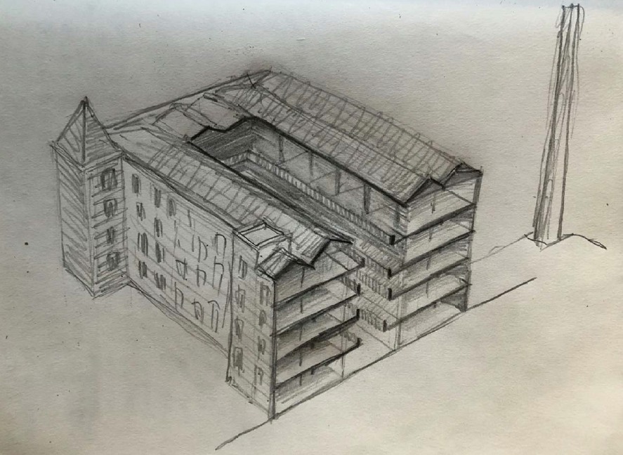
The hand sketched isometric drawing made from the aerial photography to understand the three-dimensional spatial form of the building. Hand drawing is a quick way of finding out how the building works. Clients sometimes find them more communicative than finished architectural drawings.
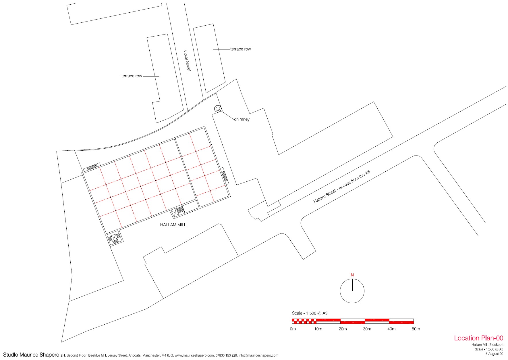
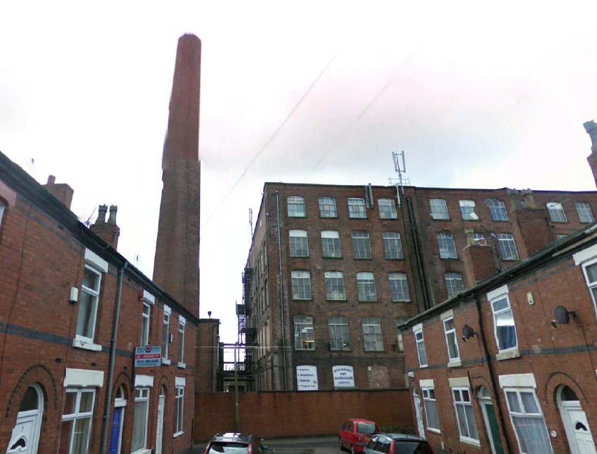
Location plan, derived entirely from Google Earth. Site context, access, chimney position and relationship to surrounding terrace housing.
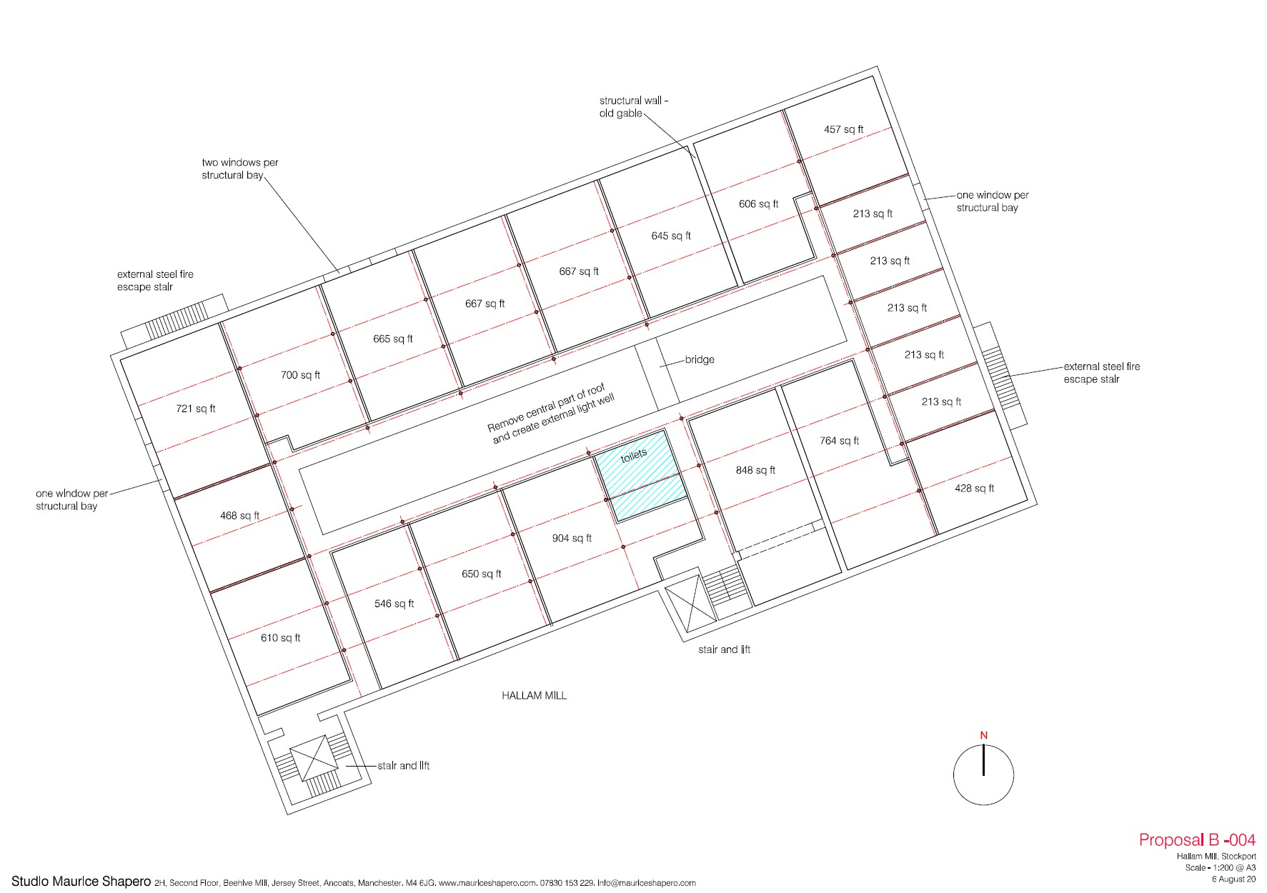
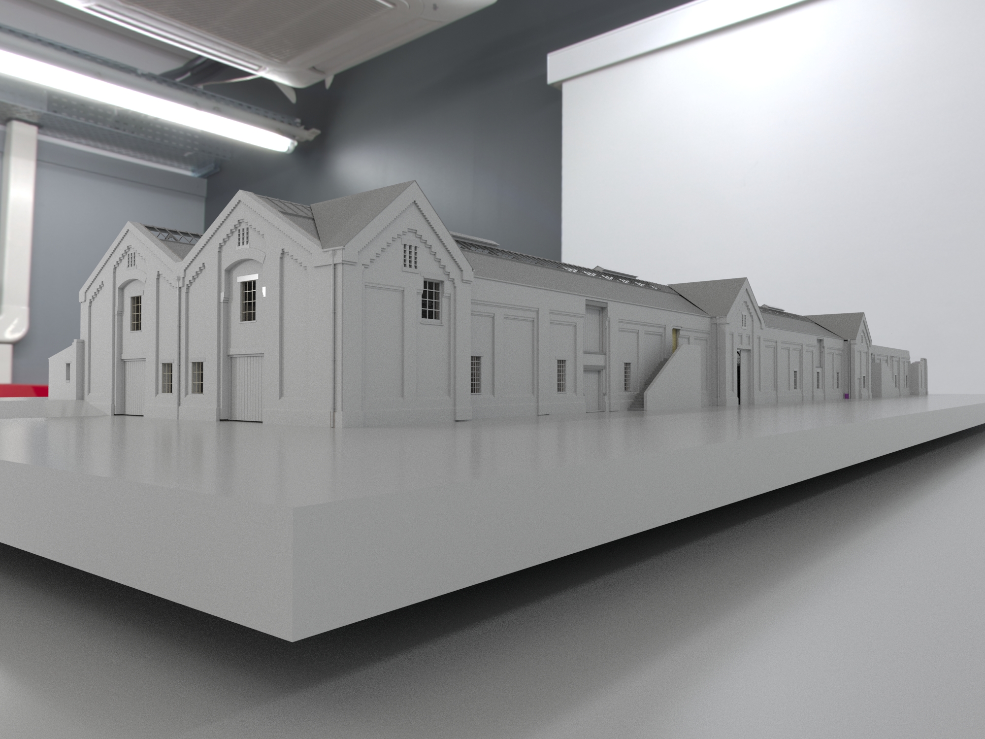
The structural grid, shown in red, was worked out by counting window bays and cross-referencing with the aerial photography. Proposal B is one possible reading of how the building might work as offices: individual units ranging from 213 to 904 sq ft, external steel fire escape stairs to the gable, and a central stair and lift core. It isn't the only answer the building offers, but it's a workable one.
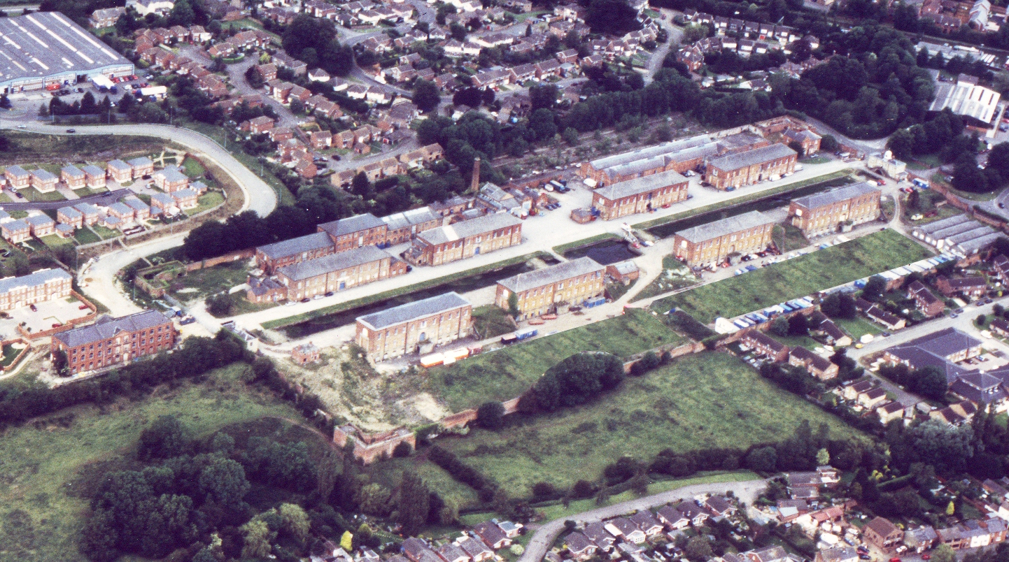
Weedon Bec is one of the most extraordinary military sites in England, an early nineteenth century ordnance depot, the entire complex Grade II* listed. The owner of the site asked me to look at one of the storehouse buildings and think about how it might work as offices. To make sense of one building you have to understand the whole site it belongs to: the parade ground, the canal basin between the two storehouse rows, the way the magazines sit at the edges. So I modelled the whole thing.
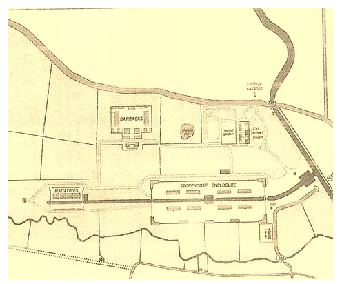
Original 1816 site plan, Barracks to the north, Storehouse Enclosure with canal basin at centre.
To understand a building, you sometimes have to model the world it sits in.
I built a complete 3D model of the storehouse enclosure, every building, every gable, every window and doorway, working from historic plans, aerial photography and site photographs. The model was constructed in Unreal Engine 5 and rendered to simulate a physical maquette, allowing the developer to see the site as a whole.
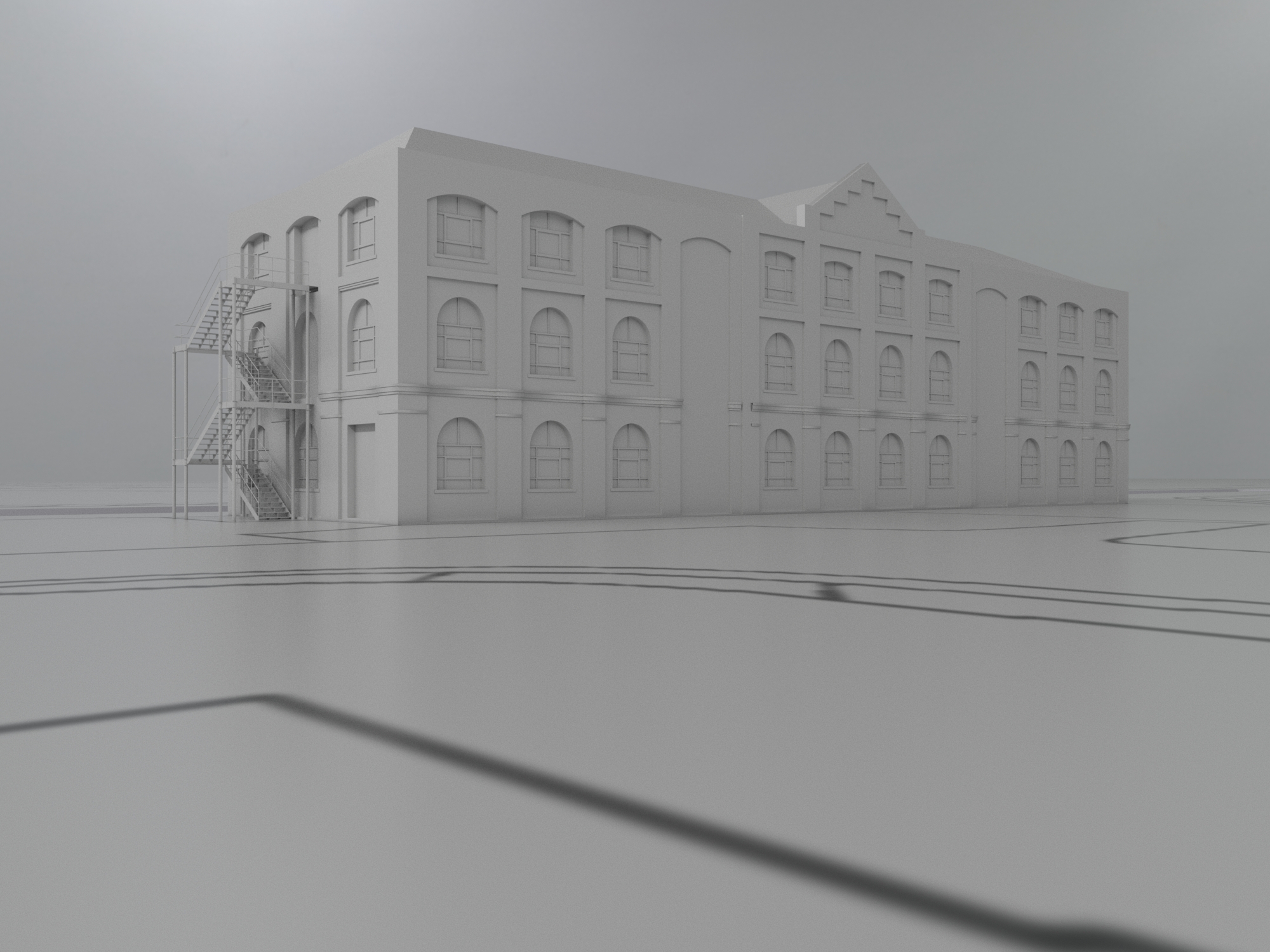
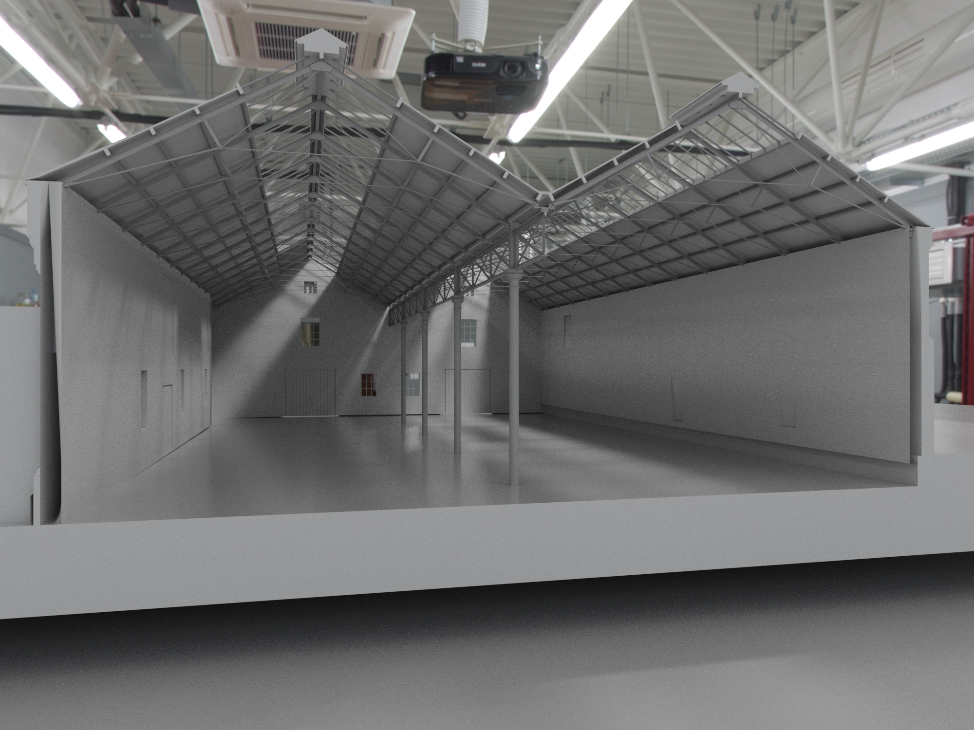
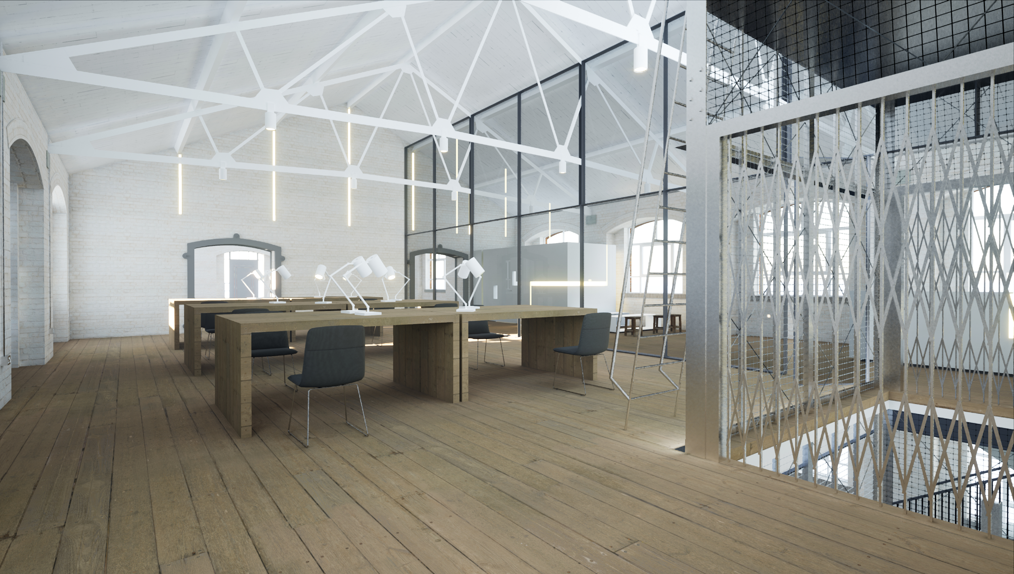
From the site model I developed office conversion proposals for Building 17. The proposal retains the full internal volume, introduces a mezzanine level, and adds an external fire escape stair to the gable end.
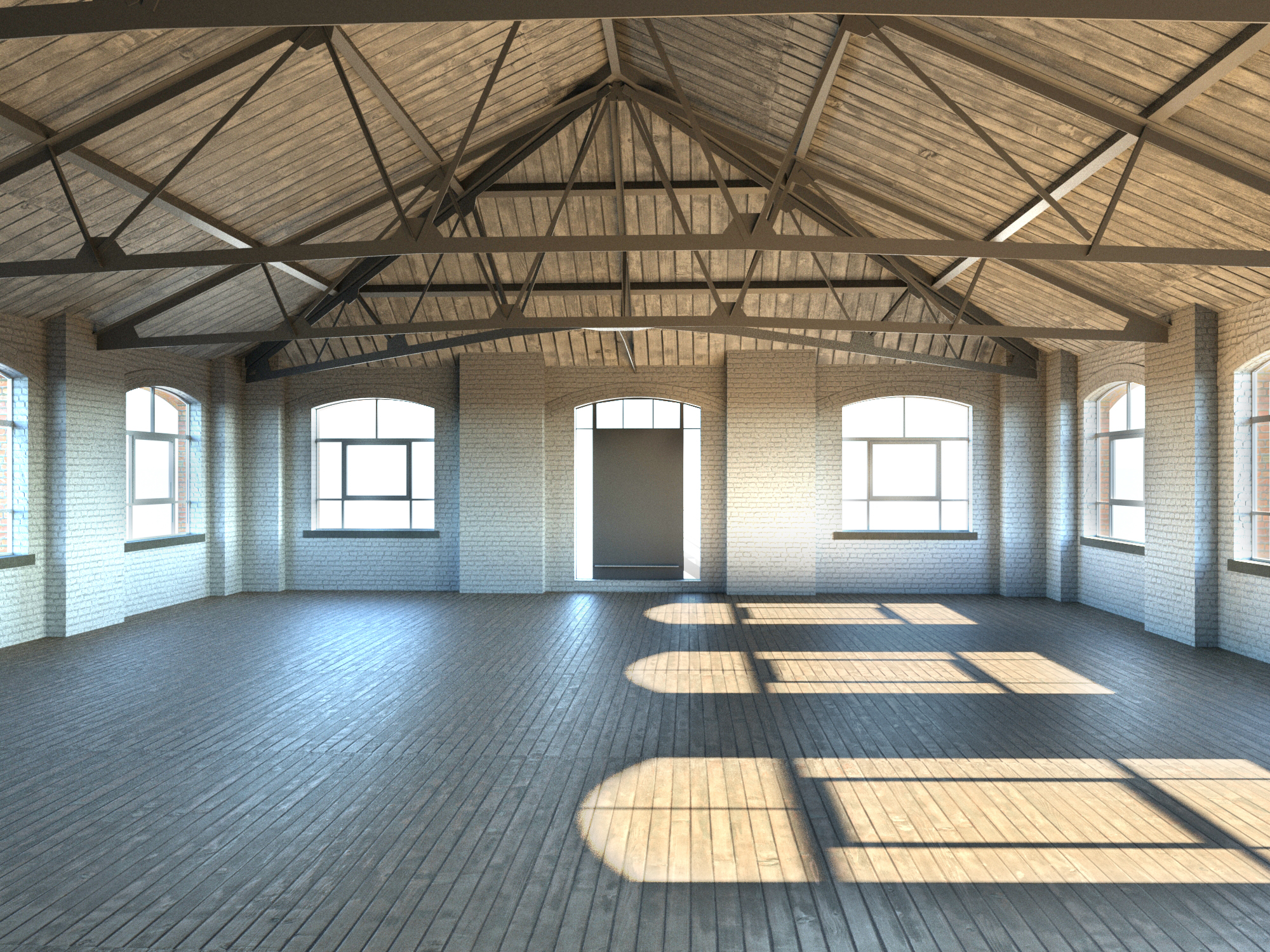
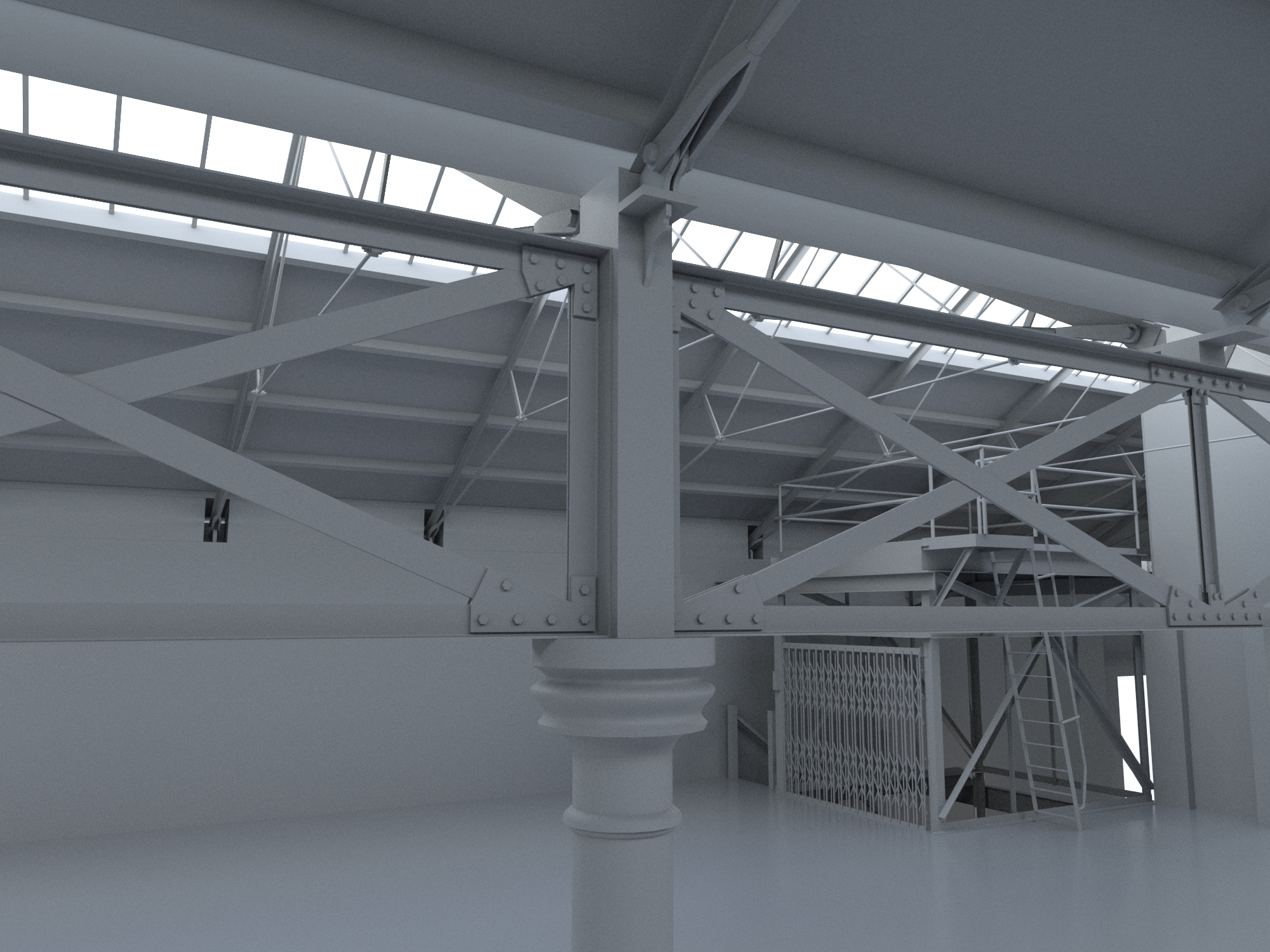
The interior visualisation gets at what's really there, whitewashed brick walls, exposed timber roof trusses, arched windows throwing light across timber floorboards. A flat technical drawing doesn't tell you what it would be like to stand inside. The point of building the model wasn't to sell anything; it was to find out what the building was really offering.
I'll keep adding studies of buildings I find interesting. If you happen to be looking at an old building yourself and would like another pair of eyes on it, I'm always happy to talk.
Get in touch